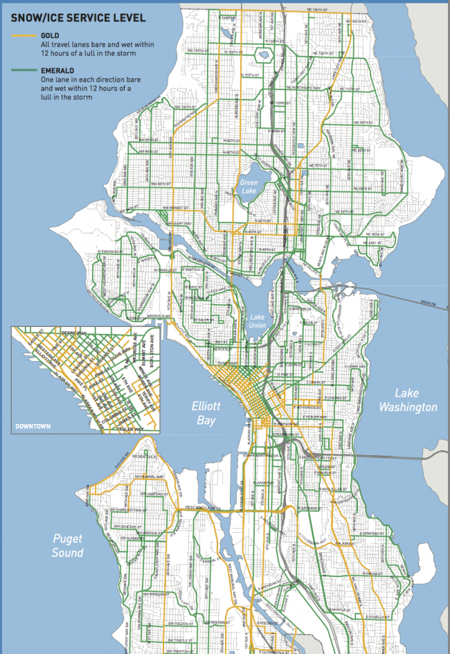
Getting there; SDOT Snow and Ice route map shows you how
The Snow and Ice Route map from SDOT shows the streets prioritized for clearance in the event of ice and snow. Bus routes and those streets that lead to major institutions, hospitals or major employers get treated first. Other streets are treated as possible or blocked with temporary signage.
Sun, 02/05/2017
With snow in the forecast for the next few days, getting around may be a challenge and SDOT has a snow and ice route map showing which roads get priority when conditions get slippery.
The map shows that California Ave SW will be cleared, all lanes bare and wet within a 12 hour lull in a storm. 35th SW will have one lane in each direction clear, bare and wet within a 12 hour lull in a storm.
As SDOT explains: "They are the streets that are most important for getting to major public institutions such as hospitals and schools, the streets that are most frequently used by police, fire trucks and buses, and streets leading to Seattle’s major employers. During a citywide snow storm, SDOT’s strategy is to treat streets of both levels of service at the same time to keep traffic moving. Remember, SDOT does not plow non-arterial streets.
There are some streets that SDOT crews will not be able to plow or treat with salt. These are the lesser traveled streets, and streets on hills that often become unsafe for the public and for SDOT trucks during periods of ice and snow.
Our crews know which steep streets often become unsafe for driving when it snows. The crews store Street Closed signs on the sidewalks at the corners of these streets at the beginning of winter so they will be available when needed to close the streets. When Seattle Police Officers decide a street is unsafe for driving, they move the Street Closed signs into the middle of the road.
For your safety, it is important to obey the Street Closed signs even if a street looks safe to you. There may be ice under the snow, or there may be a trouble spot beyond your view."


