Street concepts for light rail stations in West Seattle open for public comment
Thu, 09/05/2024
The Seattle Department of Transportation has made available the Street Concepts for areas around the light rail stations soon to be shared by Sound Transit. The full document at 60 pages HERE covers all three proposed stations including Delridge, Avalon and Alaska and draft ideas as to how they might change in the areas immediately adjacent to the stations.
CITY OF SEATTLE NOTICE OF DIRECTOR’S RULE AND ASSOCIATED SEPA DNS AVAILABLE FOR REVIEW
The Seattle Department of Transportation (SDOT) and the Seattle Office of Planning and Community Development (OPCD) jointly propose a new Director’s Rule (DR): West Seattle Light Rail Station Area Street Concept Plan, and its associated SEPA DNS. DRs are authorized in Seattle Municipal Code (SMC) Ch. 3.14.992 and 3.12.020. This DR provides guidelines for the design of future pedestrian, vehicle, and multimodal transportation infrastructure in the right-of-way, with stated goals of expanding public space, expressing community character and history, providing safer environments for people moving through the neighborhoods around the future light rail stations, and improving connections for people walking, biking, and taking transit. In general, the DR provides guidance around improving safety and accessibility for pedestrians, traffic calming measures, adjusting streets to support changing traffic patterns as vehicles access the planned light rail stations, and facilitating ease of transfer between light rail and other modes of transportation. DR DPD 2-2012 and SDOT 4-2012 are repealed.
Comment Deadline: 5 PM, September 12, 2024. The DR and SEPA documents are available through the links below and by request to the contacts listed below.·Draft Director’s Rule and Street Concept Plan Document
·Street Concept Plan SEPA Checklist
SDOT Agency Contact: Ian Macek, Ian.Macek@seattle.gov, P.O. Box 34996, Seattle, WA 98124
OPCD Agency Contact: Lucien Ong, Lucien.Ong@seattle.gov, P.O. Box 94788, Seattle, WA, 98124
From the document:
BACKGROUND
The City of Seattle has developed a street concept plan to re-envision the streets around the future light rail stations. The vision and designs for these streets will guide future implementation and further design as Sound Transit expands light rail in Seattle. This light rail expansion is the largest transit investment in our
city’s history.
The street concept plan focuses on three stations associated with the West Seattle Link Extension including Delridge, Avalon, and Alaska Junction. The plan will guide future right-of-way investments by the City of Seattle, Sound Transit, and future redevelopment.
By establishing a consistent design framework for the right-of-way to support mobility, and to enhance the pedestrian-orientation of the street, the street concept plan will provide greater predictability for the community when investments in rights-of-way within the West Seattle light rail station areas are
proposed. The concept plan was prepared with the active participation of City departments, Sound Transit, and input from area stakeholders, residents, and businesses.
The street concept plan is entitled “West Seattle Light Rail Station Area Street Concept Plan.”
RULE
The West Seattle Light Rail Station Area Street Concept Plan, having been approved by the Directors of the Seattle Department of Transportation and Office of Planning and Community Development, is incorporated into the Right-of-Way Improvements Manual as Appendix G. The Right-of-Way Improvements Manual
is the standards manual used by SDOT's Street Use Division in the permit review process for projects. Elements of development plans that adhere to the concept plan are approvable through the Master Use Permit process, including design review.
Note: Certain projects may be subject to review under City development regulations or the State Environmental Policy Act. That review could result in additional conditions relevant to the streetscape but not anticipated in the West Seattle Light Rail Station Area Street Concept Plan.
Why Street Concept Plans?
Street concept plans provide a vision and design for how a street will look in the future. Typically, these are jointly created by the Seattle Department of Transportation (SDOT) and Office of Planning and Community Development (OPCD). Street concept plans provide an opportunity to guide development and create:
• Expanded public space
• Expressions of community character and history
• Safer environments for people moving through these neighborhoods
• Better connections for people walking, biking, and taking transit
The concept plan aligns with the modal networks identified in the Seattle Transportation Plan, Vision Zero principles, and takes into consideration past neighborhood planning efforts.
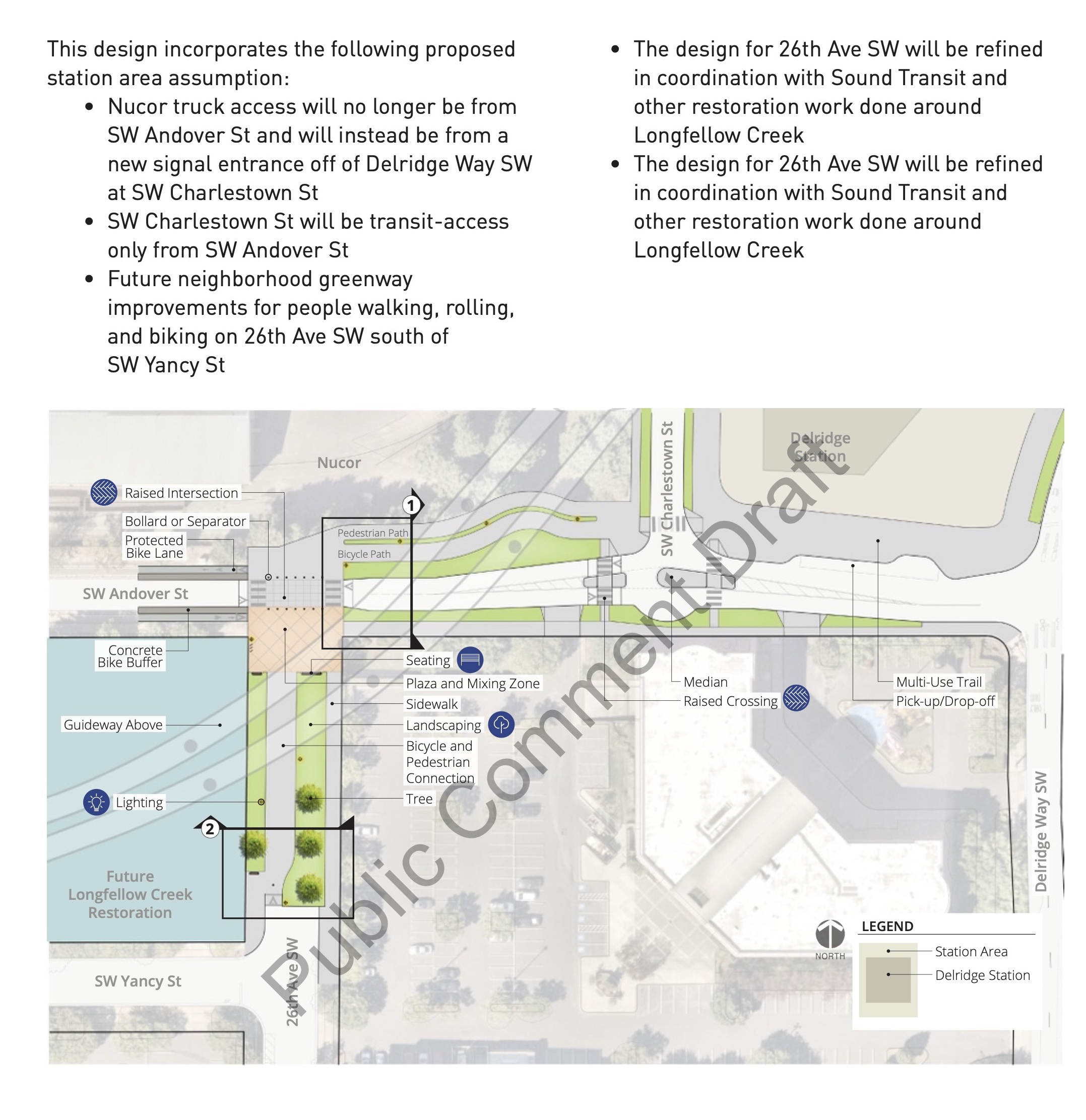
Delridge Station Street Concepts
The street concept design for the Delridge Station Area includes:
• A raised intersection at SW Andover St and 26th Ave SW
• Stop signs and a narrow crossing on SW Andover St at 26th Ave SW to keep people walking and biking safe crossing SW Andover St
• A walking-, rolling-, and biking-friendly street with landscaping on 26th Ave SW
north of SW Yancy St by closing the block to people driving
• A turn-around for people driving on SW Andover St near the station to allow vehicles to return to Delridge Way SW and reduce vehicle volumes at 26th Ave SW
• A design that can tie into the future upgrades to the 26th Ave SW Neighborhood Greenway south of SW Yancy St
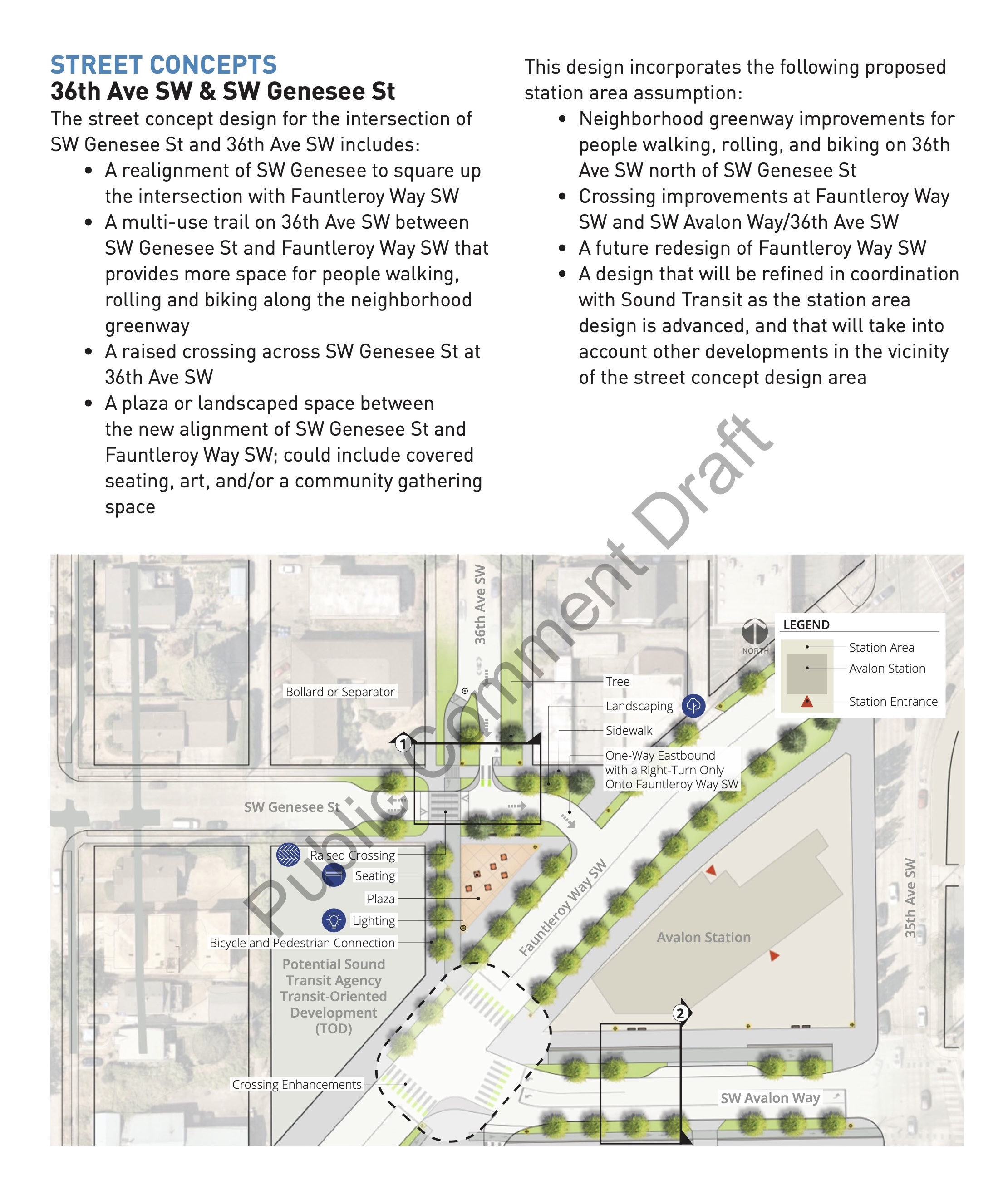
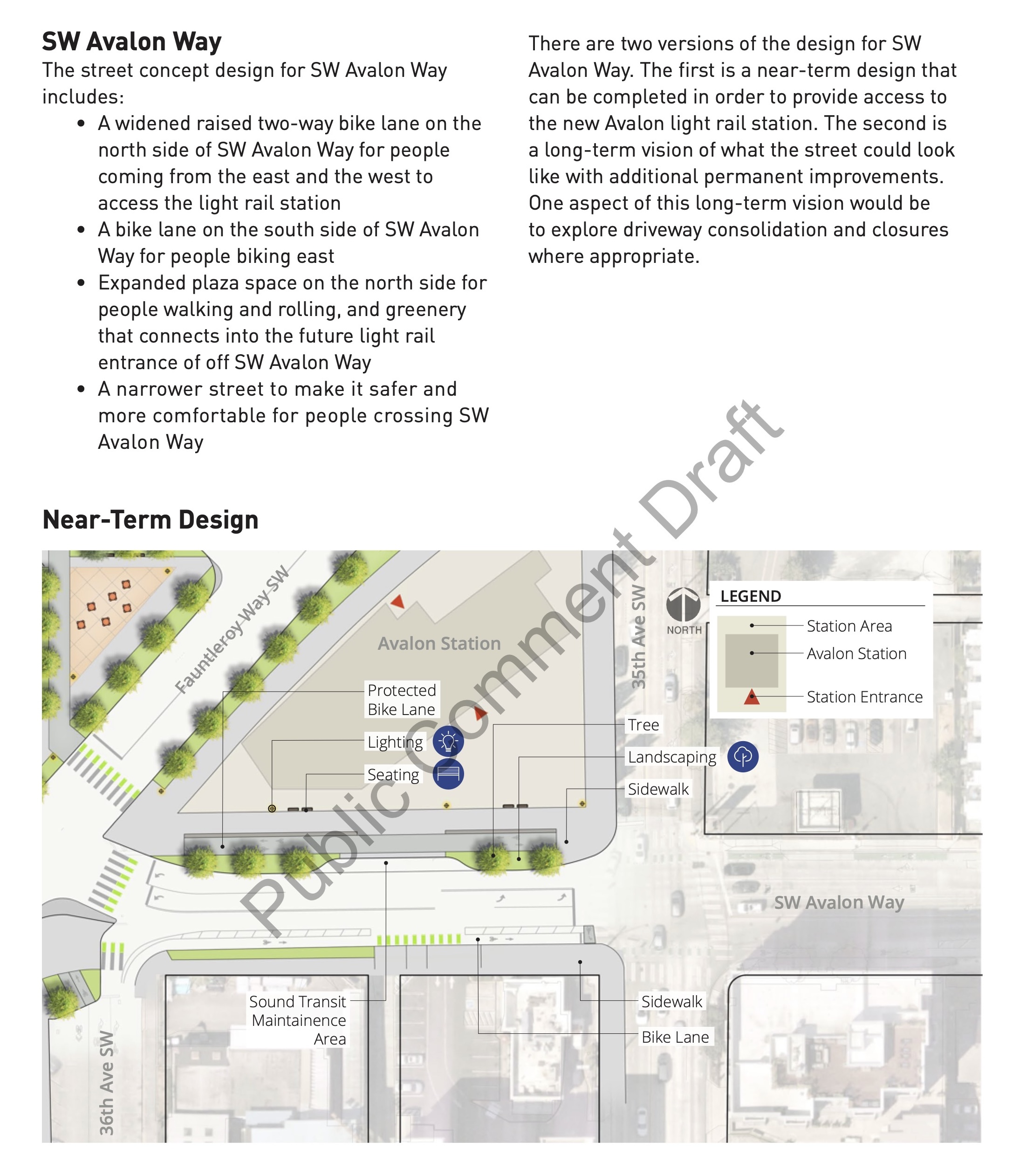
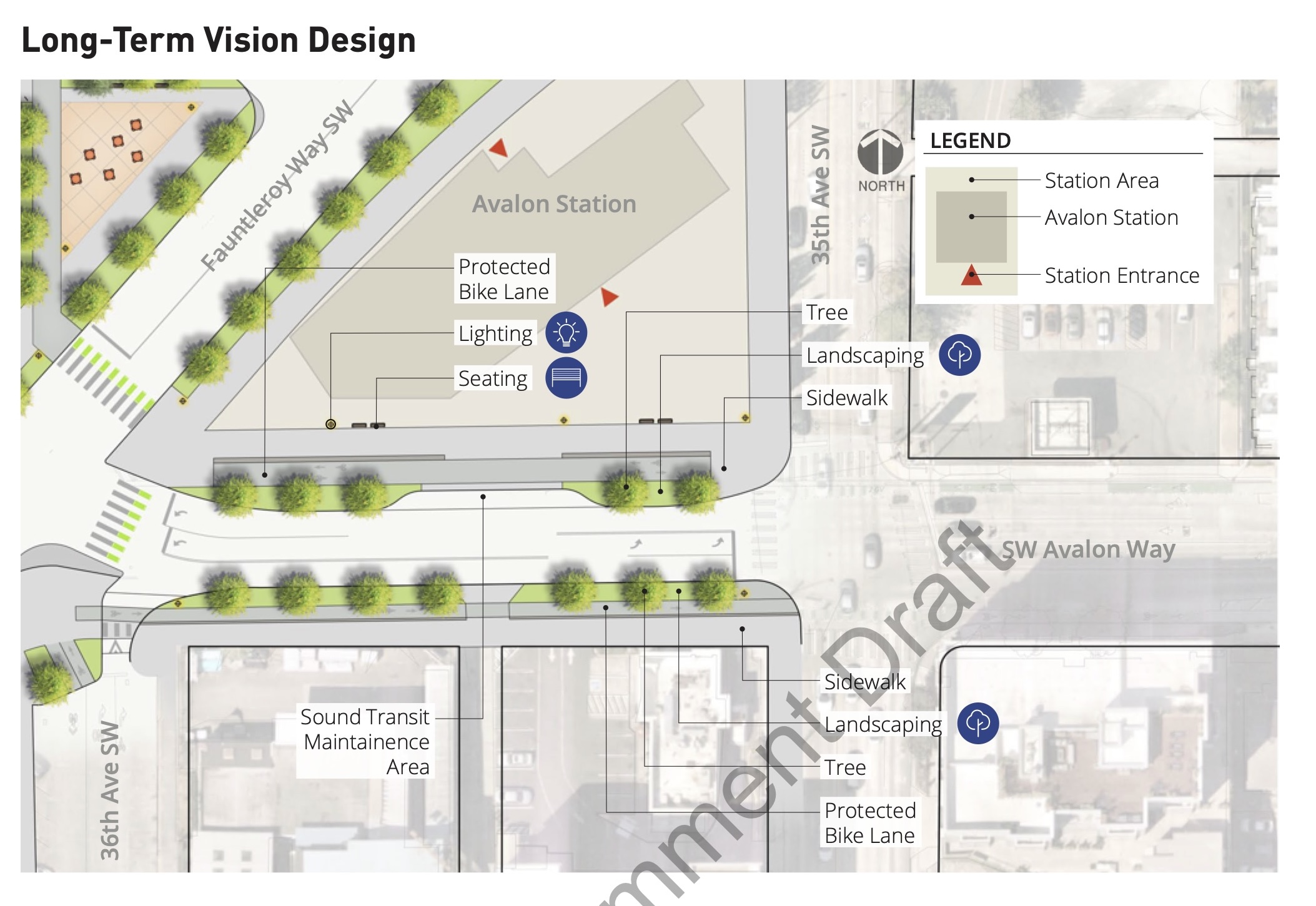
Avalon Station Street Concepts
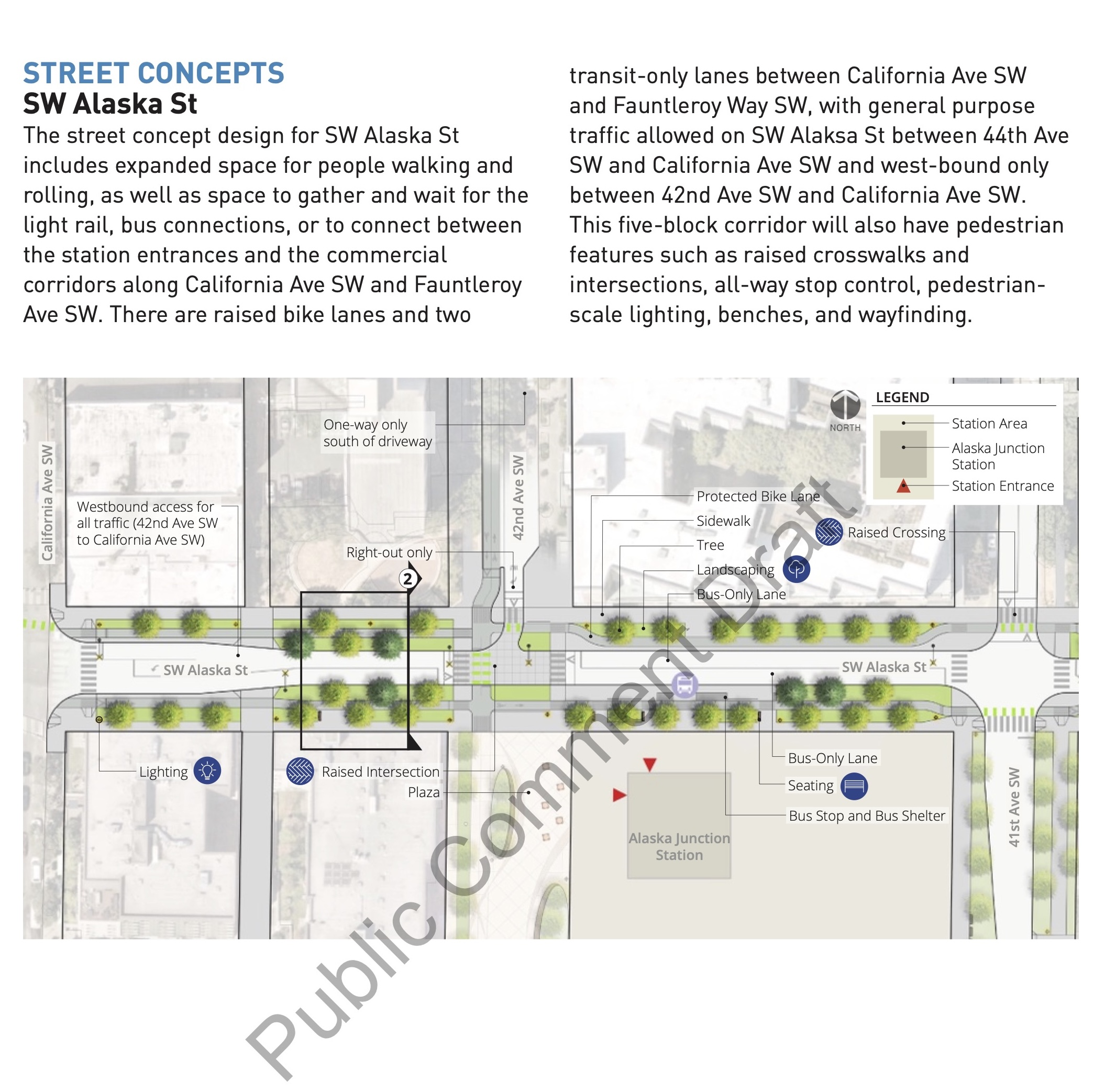
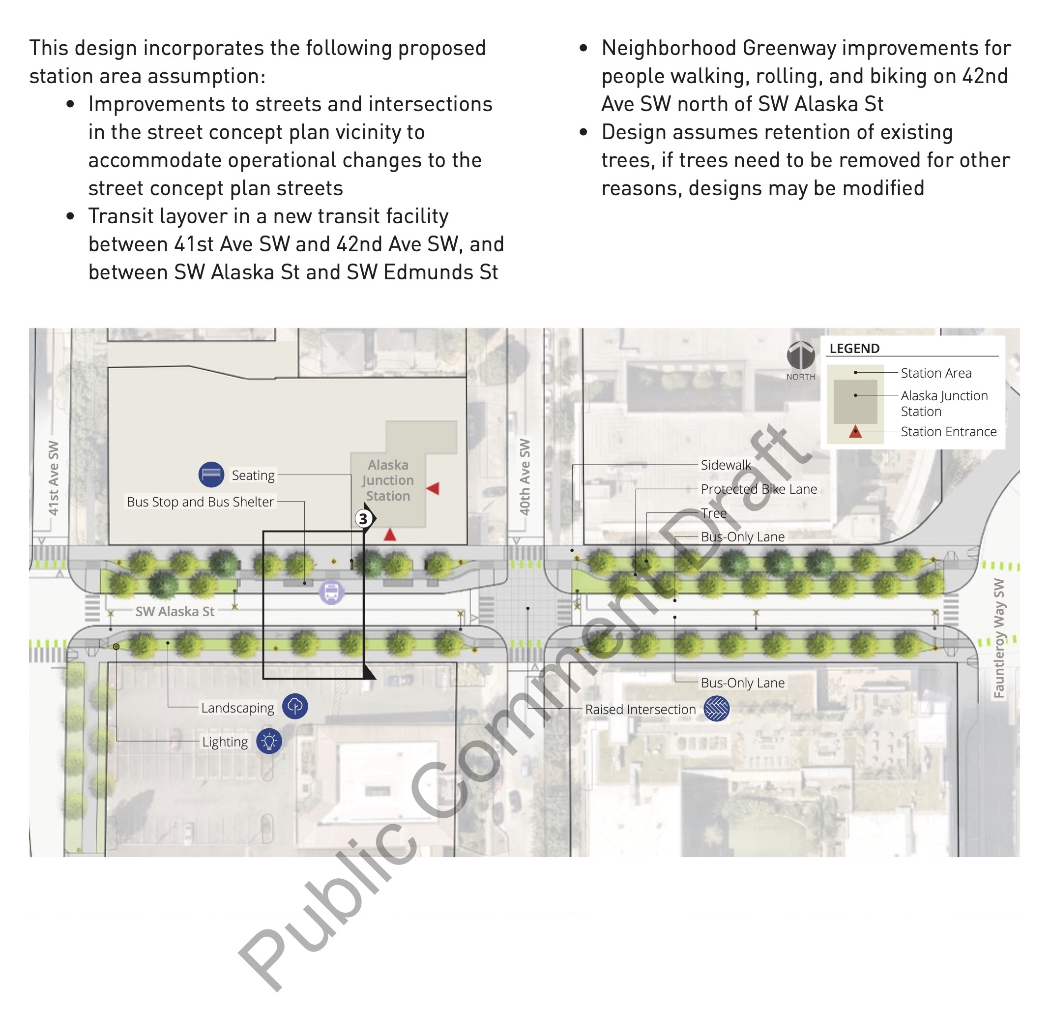
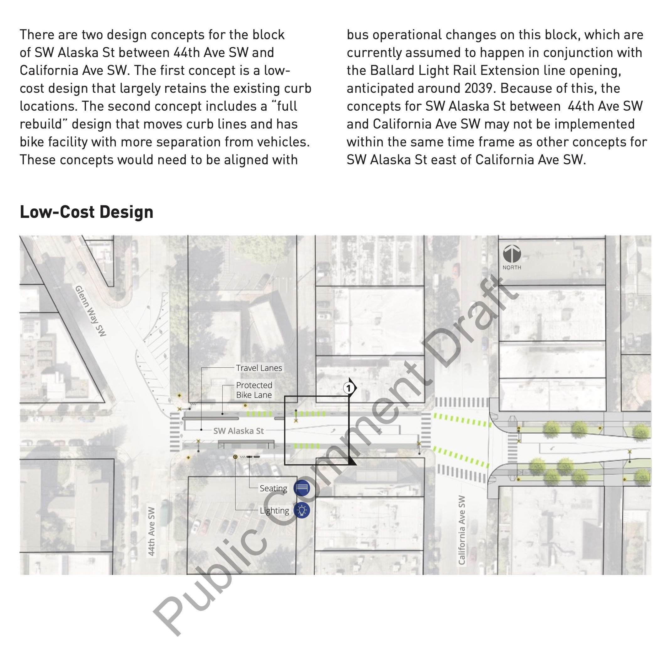
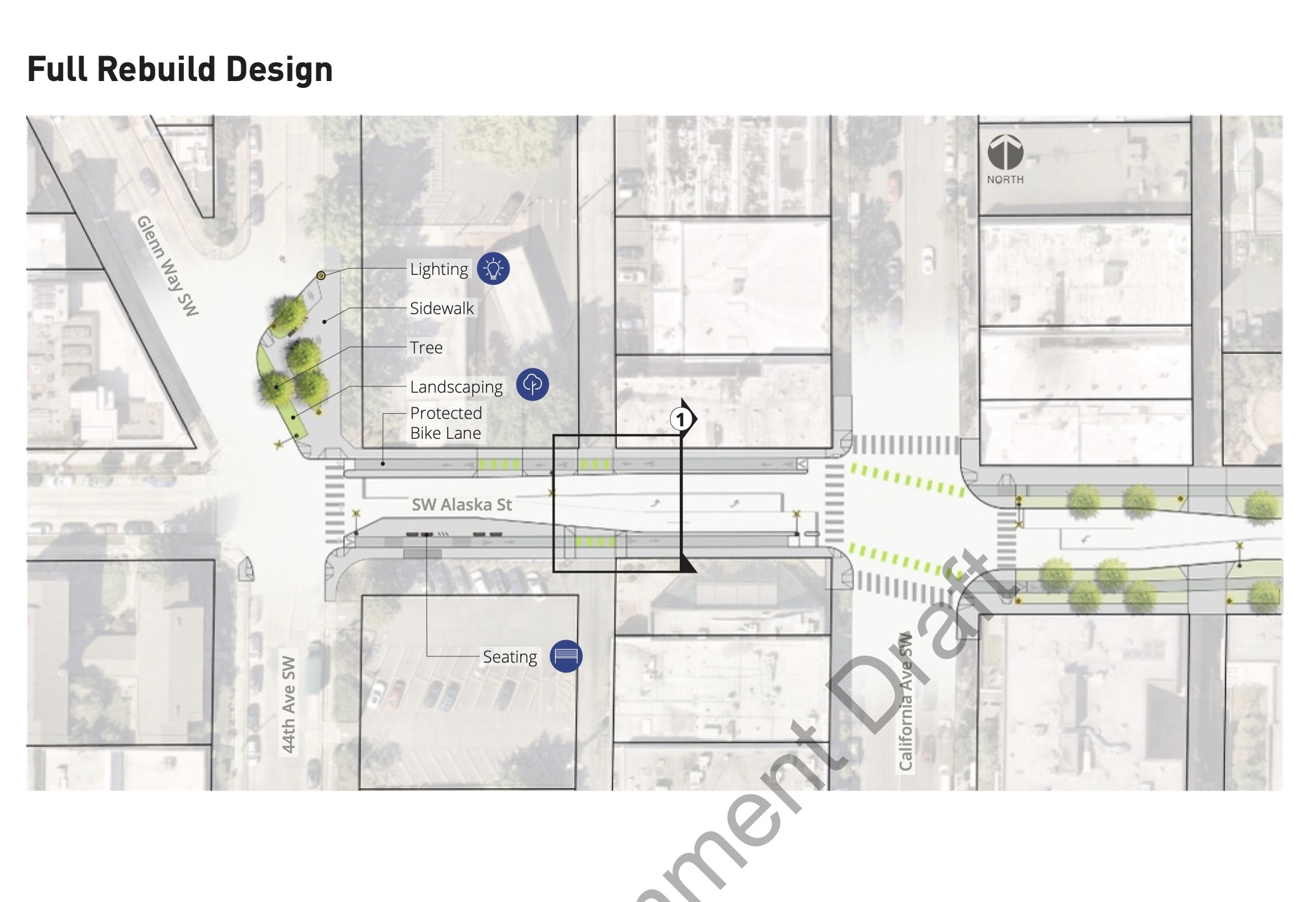
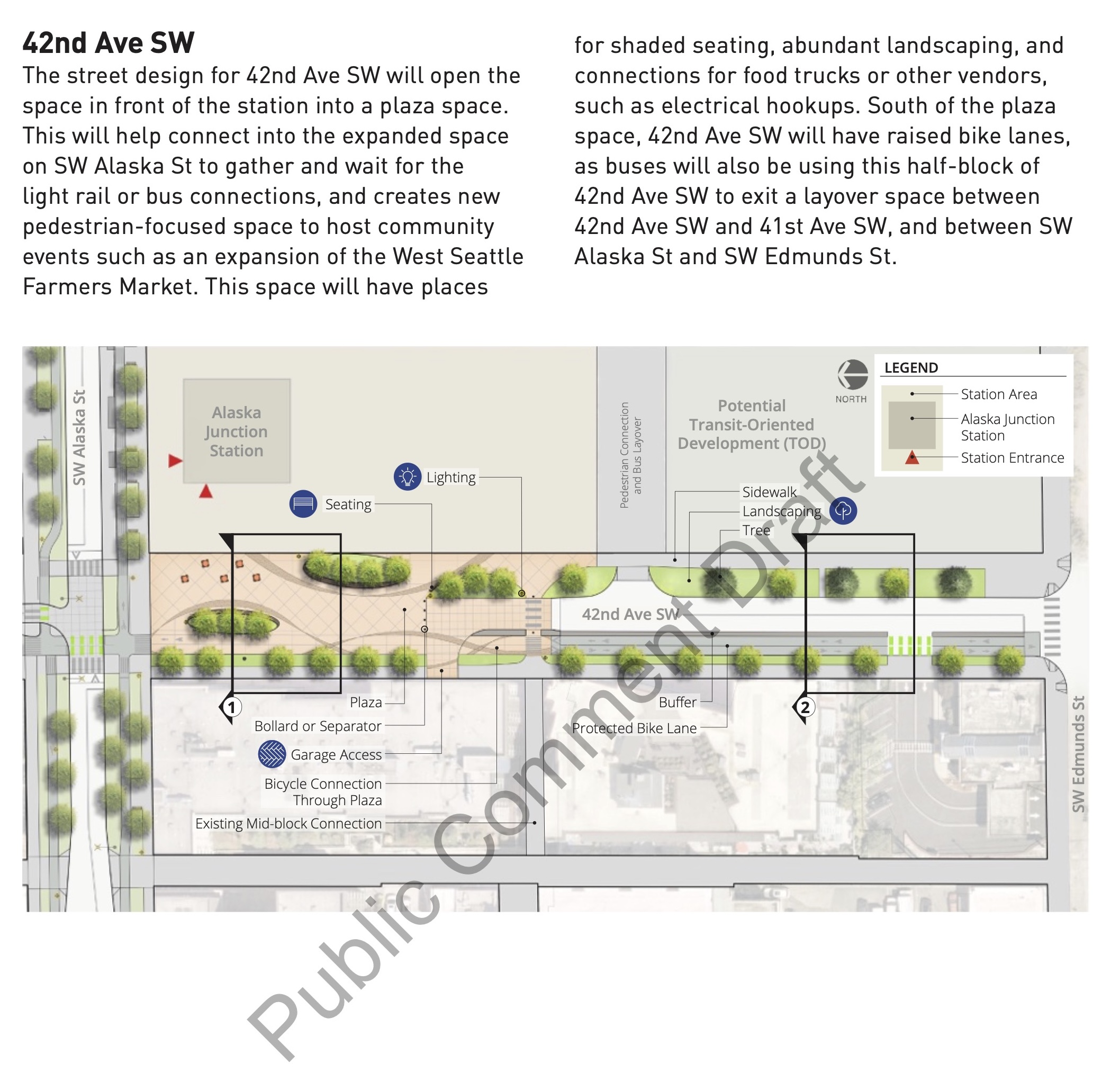
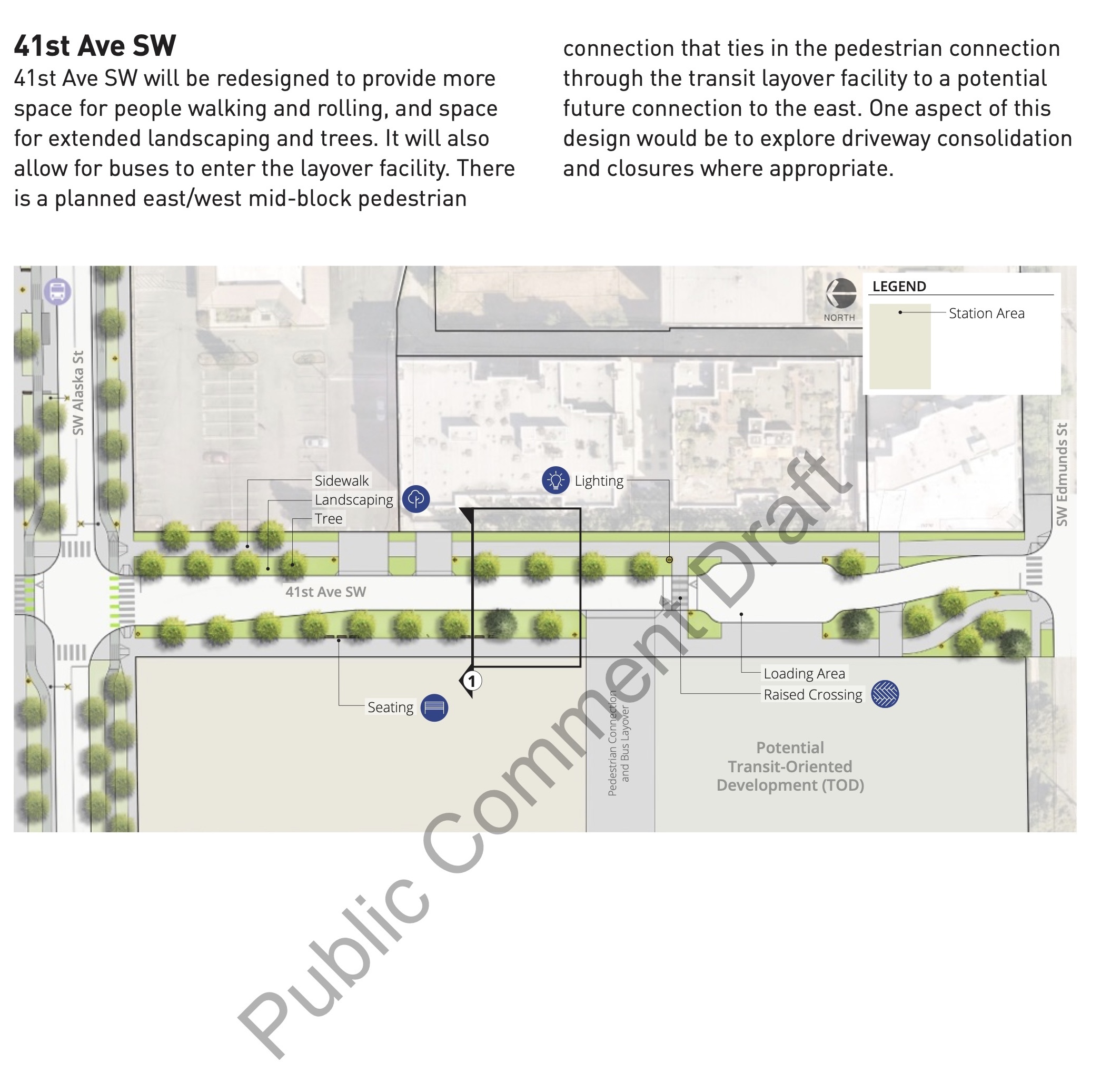
Alaska Station Street Concepts