SLIDESHOW: Duwamish River's beauty belies the Superfund story underneath
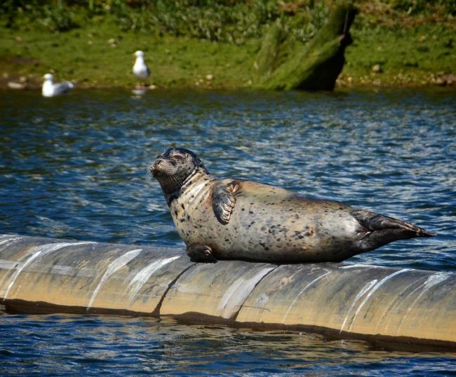
A sea lion sunning himself with ample style on a Duwamish River dock float. PLEASE CLICK THE IMAGE ABOVE OR SEE BELOW THE STORY FOR MORE
Thu, 09/12/2013
Over the past 100 years, the Duwamish River near Elliot Bay has transformed from its natural state as a massive estuary with tidal marshes, mud flats, riparian habitat and forested wetland into an industrial row that has become home to boat building, timber and pulp mills, shipping and more.
With that change came the residuals of industry, making the Duwamish one of the nation’s most polluted rivers. However, the beauty of the Duwamish - from its shimmering surface blue to the abundant wildlife still living and playing there – sometimes obscures the real dangers that lurk below in the riverbed.
Earlier this year, the Herald toured the river with Port of Seattle employees and Patrick Robinson took these photos we share with you now.
Background
The Environmental Protection Agency (EPA) has deemed the five mile stretch reaching from the mouth at Elliot Bay on south the “Lower Duwamish Waterway Superfund Site.” The EPA explains: “A century of heavy industrial use has left the toxic waterway contaminated with toxic chemicals from many sources – industries along its banks, stormwater pipes, and runoff from upland activities, streets and roads.”
Over 40 pollutants have been identified in Duwamish River soil, including PCBs and arsenic, and over time those pollutants have made their way into the crab, shellfish and bottom-feeding fish populations, making them a health risk to eat.
The EPA has a proposed cleanup plan in place that will cost around $305 million and could stretch well beyond 15 years as they cap sources of pollution and dredge the soil to remove contaminants all along the five mile stretch.
Earlier this year, when asked if the goal of reducing PCBs by 90 percent will be enough for people to regularly and safely eat shellfish and bottom feeders one day, EPA’s Allison Hilltner told KUOW, “We’re gonna try to get it as best as we can. But we don’t want to make false promises and say we can get to unlimited consumption.”
Regardless of those warnings, there are low income communities all along the Duwamish who use the river as a major source of sustenance.
In what the EPA calls “Early Action Areas,” cleanup efforts are already underway, and most are being performed and paid for by the big four polluters, known as the Lower Duwamish Waterway Group (LDWG)comprised of the City of Seattle, King County, Port of Seattle and Boeing.
While the LDWG is supportive of much of the overall cleanup plan, they’ve said the EPA’s goals for reducing PCBs in sediment and fish tissues will be hard, if not impossible, to meet.
BJ Cummings with the non-profit Duwamish River Cleanup Coalition, while saying the EPA’s plan “is going in the right direction … the problem all along has been that it does not proved adequate health protection for some of our most resource-dependent, vulnerable communities, particularly those who have any kind of cultural or subsistence relationship to the river.”
There is hope that the cleanup effort will revitalize the communities of South Park and Georgetown as more green space and a more hospitable shoreline are created over time, but along with that is the concern shared by UW researcher and professor William Daniell, who said gentrification of those neighborhoods could force low-income residents out of the area if not managed properly.


